AC Transit Overview Maps
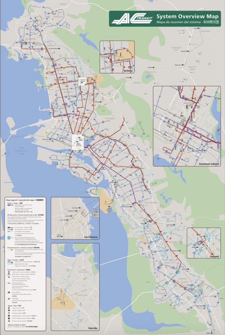
System Overview Map
The new AC Transit System Overview Map makes it easier to explore where the AC Transit bus system can take you. Riders can explore, plan, and ride AC Transit with the help of this new, simplified map, which was created after extensive public consultation and internal development.
With the AC Transit System Overview Map, you can easily:
- Explore where AC Transit can take you using a simplified geography
- Identify the most heavily served lines through their more vibrant colors and thicker lines
- Connect with points of interests and discover which lines will get you there
- View all of AC Transit’s service area at a glance
The map is available online, posted at some stops, and available in print. Printed maps are available by:
- Visiting the AC Transit Customer Services located at 1600 Franklin St. in downtown Oakland
- Mail when submitting a request on our Request Timetables page. Select “AC Transit System Overview Map” from the “System Map” menu
- Calling 510-891-4777, option 2, to request one from a Customer Service agent (available Monday—Friday, 6:00 am—7:00 pm, and weekends/holidays from 9:00 am—5:00 pm)
The map will be available at more stops as schedules are updated.
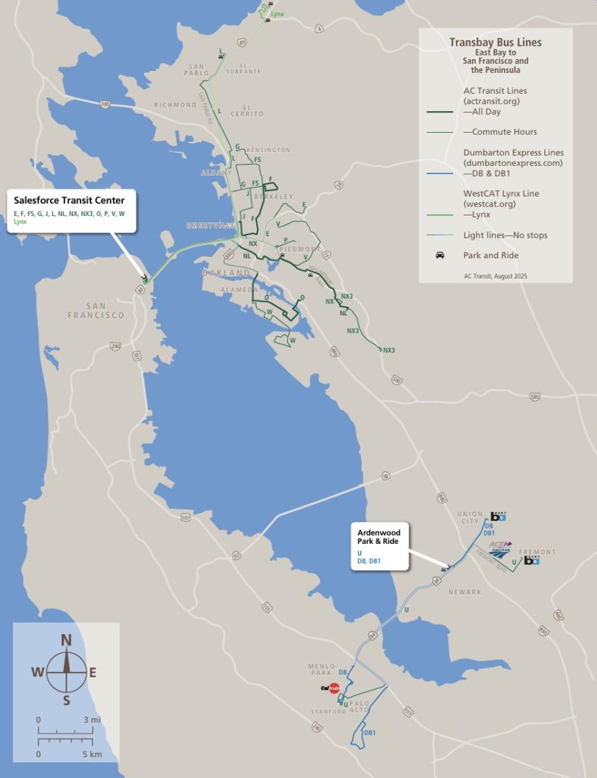
Transbay Overview Map
This simplified map shows an overview of AC Transit and Dumbarton Express service from the East Bay to San Francisco or the Peninsula, making it easy to see what areas have bus service across the San Francisco-Oakland Bay Bridge, San Mateo-Hayward Bridge, and Dumbarton Bridge.


